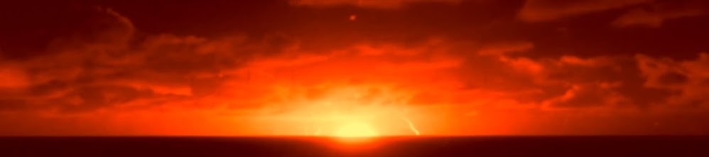
Title scene, eliminating the olive-yellow cast:
Joint Task Force 8 was the military command structure of the operation.
Scenic, dynamic views of Earth from a rocket camera:
The Pacific basin from above the test island:
Project 8C AVCO reentry vehicles like these generated severe outboard aerodynamic problems for the rockets, causing all of them to fail.
Low pressure eddies drew the hot turbine exhaust plasma back up and along the skin and inner support
structures. In one test, a primary support frame for the rocket motor weakened from the tremendous heat, sending the motor up and through the inside of the missile.
The plot was to orient the vehicles below yet 90° side-on to the thermonuclear burst, but the rocket shown below blew up one minute after launch at 30 000 feet (9.1 km). Both the ribbon brakes and the 24-foot (7.3 m) parachutes failed, ceasing telemetry on surface impacts. One of the vehicles was later discovered on Johnston Island, crushed, twisted, and ruptured.
A backup test for testing reentry kill vehicle effects for a detonation was the low-yield (< 20 kilotons) Marshmallow underground nuclear test on 28 June, 1962, in an Area 161 tunnel at the Nevada National Security Site. Marsh- mallow as part of Operation NOUGAT.
Source:
Operation DOMINIC Project Officer Report, Project 8C, REENTRY VEHICLE TESTS, M. J. Rubenstein Capt USAF, J. E. Dieckhoner, 1st Lt USAF, R. W. Dixon 1st Lt USAF, Air Force Special Weapons Center, Kirtland AFB, New Mexico. Issued 3 July, 1963.
The next step is to convert this film to a 16/9 aspect ratio, for viewing on modern American televisions:
Compare the above sequence to the same film posted by somebody else on YouTube:
This shot composition of a Thor missile from under its movable shelter is strangely remarkable, with white on white:
BLUEGILL as it was standing by to launch, but was remotely destroyed by the Range Safety Officer shortly after 5 minutes of launch, because of a lost radar tracking signal:
 BLUEGILL PRIME's launch of a likely 400 kiloton warhead -- the actual yield is officially classified -- descended into chaos at ignition of the Rocketdyne S-3D engine (also known as LR79-NA by the U.S. Air Force):
The Range Safety Officer activated the warheard self-destruction command, sending the nosecone skyward:
Aftermath ...
The plutonium-contaminated remains of BLUEGILL PRIME stood silently after a sticking fuel valve created an imbalance with the oxygen supply, flushing kerosene fuel out of the nozzle, causing a massive fire and explosion. The RSO forced the asymmetric destruction of the warhead on the launchpad, resulting in a large environmental safety problem and a demolished launch site that required months to clear and rebuild.
One instrument pod and two reentry vehicles were destroyed in the fire.
The launch area after reconstruction:
By November 1962, the Air Force's Thor program was retired and succeeded by the Delta rocket series.
This appears to be a Strypi rocket below, on Johnston Island. Black sidebars on the alternate widescreen format were removed for this posted image.
Are those Recruit boosters like those used on the CHECKMATE warhead launcher?
Instrument rockets wait for launch. A Strypi is to the right and a Javelin to the left.
The STARFISH PRIME warhead detonated at 250 miles (400 km), forming a green disk. Powerful radiation stimulation of nitrogen atoms caused the green glow.
The direct bomb debris, seen as a whitish-blue spot, generating intense
X-rays. Smoke trails linger from probe rockets passing through the
fireball zone.
Quickly after this moment in the sequence, the fireball faded to purple:
Seen from the Hawaiian island of Maui, the D-layer of the atmosphere illuminated in a brilliant white display, followed by red and green auroral phenomena.
For scale, the Moon is to the upper right in this perspective:
 A 'Quick Look' at the Technical Results of Starfish Prime
, published in August 1962, details an observer account of the STARFISH PRIME event:
"At
Kwajalein,
1,400 [nautical] miles [2,600 km; 1,600 mi] to the west, a dense
overcast extended the length of the eastern horizon to a height of 5 or 8
degrees. At 0900 GMT a brilliant white flash burned through the clouds
rapidly changing to an expanding green ball of irradiance extending into
the clear sky above the overcast. From its surface extruded great white
fingers, resembling cirro-stratus clouds, which rose to 40 degrees
above the horizon in sweeping arcs turning downward toward the poles and
disappearing in seconds to be replaced by spectacular concentric cirrus
like rings moving out from the blast at tremendous initial velocity,
finally stopping when the outermost ring was 50 degrees overhead. They
did not disappear but persisted in a state of frozen stillness. All this
occurred, I would judge, within 45 seconds. As the greenish light
turned to purple and began to fade at the point of burst, a bright red
glow began to develop on the horizon at a direction 50 degrees north of
east and simultaneously 50 degrees south of east expanding inward and
upward until the whole eastern sky was a dull burning red semicircle 100
degrees north to south and halfway to the zenith obliterating some of
the lesser stars. This condition, interspersed with tremendous white
rainbows, persisted no less than seven minutes."

Star trails give a clue to the time exposure of image above.
CHECKMATE
in colors according to Johnston Island launch site observer records. It
also intercepted a reentry vehicle, as a study of nuclear fireball kill
mechanisms.
The brightest region is the warhead debris field.
Purple streamers became intense to the eyes of Johnston Island observers.
The KINGFISH warhead plasma debris field
The spiral lines were fireball environment probe rockets' exhaust trails
The heart of the KINGFISH burst, in this scene's sequence:
A suspected Javelin missile in its mounting transport at Johnston Island. Javelins were used in the STARFISH PRIME test:
The image above is a new test round on 16 March, 2014.
USNS Range Tracker (T-AGM-1) was operated by the Military Sea Transportation Service during DOMINIC I, and was manned by a civilian crew. She started her existence as for the Northland Transportation in 1945, and later with American President Lines as
President Bucahnan, but was converted to military service in the late 1950s. From 1961 - 1969 she was a heavily instrumented ship with the Western Launch Range, which covered NASA civilian space and military missile tracking from 90 degrees east longitude in the Indian Ocean to the west coast of the United States.
An ARGUS pre-nuclear test in 1958, as part of rocket stability trials:
A blurry frame during a high speed camera motion reveals color noise to the upper left, that will be removed:
Ugly magenta/tobacco colors converted to blue sky:
The Lockheed X-17A rocket raced skyward from
USS Norton Sound (AVM-1):
The three ARGUS nuclear tests were 1.7 kilotons each, yet the ARGUS experiments were the most secret of all atmospheric nuclear tests.
There was a potential military use concept at that time, requiring urgent field testing in detonating nuclear weapons inside the inner Van Allen belt. American scientists launched three W-25 nuclear bomb trials to see if stimulation with intense radiation, magnified by the Earth's natural magnetic field, could destroy enemy ICBMs. This concept was quickly abandoned, due to the extreme amount of nuclear yield required.
1958 August 27 - .
02:20 GMT - .
Launch Site: Atlantic Ocean. Launch Pad: 38.5 S x 11.5 W. Launch Platform: AVM1. LV Family: X-17. Launch Vehicle: X-17.
- Argus I Nuclear test - .
Nation: USA. Agency: USN. Apogee:
160 km (90 mi). The Argus series were the only clandestine nuclear
tests ever conducted by the United States. The rocket-launched nuclear
warheads were set off at very high altitudes over the South Atlantic,
1800 km south-west of Capetown, South Africa. The purpose was to
determine the effects of nuclear explosions on the Earth's magnetic
field and the impact to military radar, communications, satellites and
ballistic missiles electronics. The earth's magnetic field is not only
off-axis from the earth, but also off centre from the earth's core. This
means the Van Allen Radiation belts are closest to the earth in the
region known as the 'South Atlantic Anomaly'. This made the selected
launch point the ideal place for launching a rocket into the lower belt
where the particles and radiation from the explosion would be trapped.
The 1.7 kiloton W-25 warhead used had been developed and previously
tested for the Genie air-to-air missile. The first test was launched
from vessel AVM1 at 38.5 deg S, 11.5 deg. W, and exploded at an altitude
of 160 km. The initial flash was followed by an auroral luminescence
extending upward and downward along the magnetic lines where the burst
occurred. The experiment verified the predicitons made in the original
October 1957 proposal by N. C. Christofilos of the Lawrence Radiation
Laboratory in Livermore.
1958 August 30 - .
03:10 GMT - .
Launch Site: Atlantic Ocean. Launch Pad: 49.5 S x 8.2 W. Launch Platform: AVM1. LV Family: X-17. Launch Vehicle: X-17.
- Argus II Nuclear test - .
Nation: USA. Agency: USN. Apogee: 293 km (182 mi). Summary:
Second covert Argus launch to study effect of nuclear explosions on the
Van Allen radiation belts. The rocket was launched from vessel AVM1 at
49.5 deg South, 8.2 deg West; altitude reached 294 km; yield of the
nuclear warhead, 1.7 kilotons..
1958 September 6 - .
22:05 GMT - .
Launch Site: Atlantic Ocean. Launch Pad: 48.5 S x 9.7 W. Launch Platform: AVM1. LV Family: X-17. Launch Vehicle: X-17.
- Argus III Nuclear test - .
Nation: USA. Agency: USN. Apogee: 750 km (460 mi). Summary:
Third and final covert Argus launch to study effect of nuclear
explosions on the Van Allen radiation belts. The rocket was launched
from vessel AVM1 at 48.5 deg South, 9.7 deg West ; altitude reached 750
km; yield of the nuclear warhead, 1.7 kilotons.
Source:
Encyclopedia Astronautix
A Nike-Cajun rocket was prepared for launch at Johnston Island, for aeronomy experiments, meaning instrument sampling of ionization conditions of the high atmosphere. This is a new color test:
The only way to recover the missing blue sky between the clouds to the left side is to process each scene frame separately.
Areas of Johnston Island have white coral sand. A possible M54 truck was parked in the background.
Launchers for rocket instrumentation gathering data on the nuclear tests:
This Boeing C-18A Stratoliner was converted to a technical photography platform, for fireball studies:
A Boeing KC-135A Stratotanker kept aircraft flying around the test area.
The standard Thor launch pad in horizontal position:
Three Lockheed EC-121 Warning Stars were airborne command centers for flight operations, callsigned "Abusive" under a JTF 8.1 program titled
BLUE STRAW:


 Crew readied a McDonnell Douglas F-4 Phantom for takeoff from above the fantail. 3 Grumman A6Es were parked at the upper right. A Lockheed S3-A Viking was near the centerline.


